Status of this blog

The time has come to archive this blog. The purpose of this blog was to serve as a historical account of wide-scale pollution that lasted over 100 years that affected many lives. History is important. Without it, we will repeat the same mistakes. In this fast-paced modern world, it gets buried online and we can’t let it be forgotten. People come and go, and local folklore is lost when those who lived it are no longer around to tell the story. Thankfully, with the internet, we can create a record of what happened. There are still many documents on the internet that detail the pollution, the fight of citizens to stop it, the bankruptcy of a giant, and the plans developed by the EPA to clean up the pollution. All of which can be printed out, screen captured, or downloaded for future preservation. I encourage you to do so. Create an archive. Tell the story to younger generations so this will not happen again.

Progress

Looking at the 2019 Toxic Release Inventory report, you can see significant improvements in pollution. It is an improvement from the 1980s and 90s.

The Kings Landing wastewater treatment facility TRI report gives some insight into the current pollution of the Genesee River which is significantly less. I still get reports sometimes from local residents about the smell at King’s Landing.

Researching:

When doing internet searches for old articles, the following terms are helpful:  

EPA, Kodak, Rochester

  • Kodak, Rochester, Cancer Clusters
  • RED Rochester, Kodak
  • Kings Landing Wastewater Treatment, Rochester
  • Weiland Road, Toxic Waste, Kodak
  • Dump sites, Kodak, Rochester
  • NY DEC, Kodak

The Democrat and Chronicle is also a great resource for old articles involving Kodak, and many show up online. This article from May 2003 called Kodak’s Toxic Moments details the real life of actual residents and the health problems they endured living close to Kodak. The other is a paper about toxic releases and their effeects on health. This article mentions 23.6 million pounds of 65 of those dangerous chemicals Report on Chemical Emissions Places Kodak in a Poor Light (1988)

The EPA keeps Toxic Release Inventories (TRI) for facilities across the U.S, and they include Kodak. They can be found by visiting the EPA website and searching by address, zip code, or company name.

Residents:

If you are a resident and want to know how things are today, you can contact Genesee River WatchCitizens Environmental Coalition, or NY DEC

If you are experiencing pollution from The Park, report it to the NY DEC or the EPA. They can assist you.. 

My Final Note

What happened to those living around Kodak was a tragedy and one that should not be forgotten or repeated. Many, including children, suffered rare cancers or illnesses, and some died. Yet nowhere is there a victims wall to remember them. While many are nameless to me, some are not. I knew them, and their lives were cut short. It was one of the driving forces for this blog. They were victims of a time when no one thought twice about dumping chemicals out the back door on the ground. It was a time when corporations were not accountable while pumping tons of cancer-causing chemicals into the air or on the grounds.

This same story happened all over the country, anywhere industry resided. It is still happening today. While we have better oversight, it’s far from perfect and industrial pollution continues. It’s only through citizens’ actions that these things change.

This blog was to tell the story of those who lived under the stacks. We wanted to leave a record of what happened there so that future generations may learn and avoid repeating this horrific environmental disaster.

The Park Now

Eastman Business Park as it’s known has changed significantly in the past 10 years. Much of the buildings are rented to other companies that use the infrastructure The Park offers. This website details the companies operating in The Park.

Tenant List 2016

Tenant List 2018

The pollution levels have significantly decreased since 2014, which can be seen on the 2020 Toxic Release Inventory for Eastman Business Park Kodak.

Below is the 2020 TRI for RED-Rochester which owns and operates certain infrastructure in Eastman Business Park (steam, electric, water, and more):

It is unclear if either of these includes the other companies that operate in The Park. It is more likely that each company on the tenant list would have their own reporting and Toxic Release Facility number so instead it can be more helpful to look at the TRI for the zip code of their location instead.

TRI for the 14615 Zip Code

List of chemicals released between 2018-2020 for the 14615 zip code.

One of the primary discharges are nitrate compounds which are likely the result of wastewater treatment sludge processing according to this EPA document on nitrate compounds. Many of these color charts look menacing but they are largely improved from any TRI’s pre-2015. In any case, hopefully this information helps residents make sense of what is in their environment today versus what used to be.

To date clean up is still underway and details are outlined on this EPA webpage. It is heartbreaking to hear how extensive the contamination was, but it’s recognized now and being remediated as feasibly as possible.

EPA site: Eastman’s key documents are accessible online:

Notes: Most of Kodak’s Elmgrove Plant is a shell of itself and now leased by other companies. I’ve read in some documents that it has a hazardous waste incinerator but I have not been able to verify if this is still being used. Most of the film operations at Elmgrove were moved back to The Park in 2001 when Elmgrove closed.

The Cancer Maps

I get inquiries from time to time asking if there are still cancer clusters and what things look like today. I’m not a statistician, but from what I can determine looking at the cancer maps for NY from 2003 and 2015, I think the situation has improved. These maps included all cancers reported in the state, and some, like lung cancer, may be attributed to lifestyle or other exposures since not everyone in County 31 lives within 5 miles of the stacks.

The 2003 maps are years before Kodak’s clean-up and demolition of smokestacks. They were still fully operational at that time. The county did a childhood brain cancer cluster study in the mid 1990s but I have been unable to find this document online. If you come across please comment below.

Comparison of more recent rates of two rare cancers reported by residents in the 80s and 90s:

  • 2003: Liver intrahepatic bile duct cancer: 10 cases
  • 2014: Liver intrahepatic bile duct cancer: 6 or 7 cases
  • 2003: Brain cancer: 8 cases
  • 2014: Brain cancer: 6 cases

*These rates are for the whole county.

The 2015 map is after much of Kodak was scaled down and there were a lot less toxic releases. One of the things I did notice was the reduction of liver and intrahepatic biliary cancer. This was one of the rare cancers reported by citizens in the area. This is attributed to dioxin exposure.

This document has cancer rates by county for 2015-2019. Page 34 is County 31.

Thyroid Takes a Hit

Something profusely common in The Park area were thyroid conditions. It was so common everyone knows someone, or is that someone, that has a thyroid problem. It’s hard to say it isn’t related to Kodak pollution when the thyroid cancer incidence for 2011-2015 circles Kodak Park.

Source: New York State Dept of Health: https://apps.health.ny.gov/statistics/cancer/environmental_facilities/mapping/map/ (The other area mid-state happens to be around the Seneca Army Depot which is a state Superfund site.)

It was mentioned in the Alternet Kodak’s Toxic Moments article that thyroid cancer was one of the things reported by residents living near Kodak.

Kodak Park tossed a lot of chemicals into the environment, but namely methylene chloride. Fluroines, chlorines, and bromides gravitate to the thyroid taking up the spots that iodine is supposed to occupy. Unfortunately, we don’t have current cancer maps to see if this situation has improved. They should be released yearly but instead it seems to take 5 years.

What Residents Don’t Miss

It used to be a gamble waking up every morning and wondering what you would see when you look out the window. Kodak always had a habit of cranking up the stacks at night or very early in the morning. It was almost as if they thought maybe no one was looking. I’m sure it’s purely coincidence and consequently cloudy days always meant they were going full speed ahead, and a lot more smoke coming from any of the stacks on the property.

Imagine waking up to this.

©2014 Anonblogr: Taken at The Park 2014

Everyday for years. Imagine worrying if it might make your or family sick. Imagine cleaning the soot off your home or car. Imagine the coal ash and mercury exposure. No one wants to live like that. Today, there are far fewer smoke stacks than there used to be since many were torn down. There are only 2 in use and none burn coal (the one at King’s Landing, and the one for a natural gas generator). The days of waking up to some giant plume and hoping it wasn’t going to drift if your direction are gone. Thankfully after 90 years residents can breathe easier.

The Park becomes gas powered

It has been a long wait for most of us watching the process of moving from coal-fired generators in Eastman Business Park to that of natural gas.  Years actually. For some time it seemed it might not happen because of how slow the process was moving but finally in January 2018 the gas generator is running.

Gas Boilers Arrive Ahead of Schedule

Eastman Business Park Goes Coal Free

Online reports from train enthusiasts say that the last load of coal was delivered on the Charlotte line by CSX in October 2017 with the goal of burning it up by the end of the year. The train tracks will continue to be used by tenants in The Park but won’t be bringing coal. RED Rochester explains that this was the last coal plant in the area and the dirtiest. Most residents are happy to see the transition to natural gas.

Screenshot 2022-07-29 at 12-38-36 Last coal cars roll into Kodak area, making final delivery as power plant converts to gas[...]

RED-Rochester went on to explain what was taking place to change over the power plant to natural gas. When I inquired about the one remaining in use RED-Rochester confirmed it is used for a natural gas boiler.

Screenshot 2022-07-29 at 12-42-29 Last coal cars roll into Kodak area, making final delivery as power plant converts to gas[...]

Residents report that while the coal stacks for now, the end is on the horizon with a transition date by the end of the year. They see some new gas stacks in place ready to take over. Most are excited for the change and to finally have cleaner air.

No More Coal

Kodak has announced in this 2012 media report, that another company that has purchased the Kodak generation power plants and they plan to upgrade it to natural gas sometime in the next 5 years.

While I have not heard anything recently about this acquisition the paperwork was finished up in 2013.

Let’s hope RED is a better neighbor than it’s predecessors were with running the generator plant.

Now to clean up the river.

Recycled Energy (RED) finalizes deal for power plant

Burn Permit No. 6

The burn permit details a long list of chemicals, many of them are carcinogenic. According to this permit there are stipulations to be added or followed for the boilers in current operation. It references Boilers 41, 42, 43, and 44.

Boiler 41 is to be shut down in the end of 2013. Boiler 44 is to be retired or refueled by 2017. Likely the projected date of natural gas. Boiler 43 and 44 will need to comply with MACT and NESHAP. 

In layman’s terms the acronyms are EPA compliance requirements for the boilers.  Most coal boilers do not meet NESHAP. They may or may not mean a lot if you’re still burning coal.

How much coal did Kodak use in 2010?

Well turns out a lot more than most people realize. I found a 2010 article from Zack Seward at Innovation Trail that researched this question.

How Much Coal Does Kodak Burn?

Screenshot 2022-07-28 at 18-16-58 Ask a trail guide How much coal does Kodak burnThat’s a lot of coal which makes a lot of coal ash. To add insult to that, Kodak used to have 2 coal fired power plants in Kodak Park. To add to that there was Russell Station which was owned by the local utility, but it was taken off-line in 2008 and sat empty for years. It began burning coal in 1948 but it seems Kodak is King of Coal. They needed it to make 90% of their electricity and they needed the steam.

I wonder if Kodak Business Park will go to natural gas at some point. I’ve hear rumors. Maybe it will end residents finding coal on the beach and cleaning coal ash off their houses and cars.

*While Kodak was the primary coal user in the area, it’s worth mentioning Russel Station. The fate of Russel Station is rather interesting. There was talk of making it run on natural gas but the company that owned it cut the power lines to the generators when they closed it to make sure no one could fix it. It was eventually demolished. Russell Station

What is on the beach?

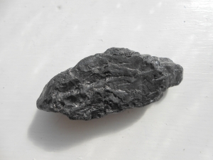
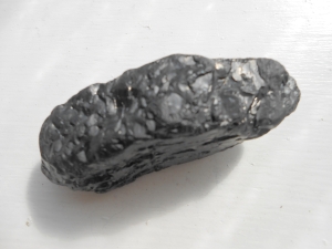
A resident out for a walk on the first warm day this year found the beach littered with bits of black coal and pieces of boiler slag.

Where is this stuff coming from? How did it get in the lake and wash up on shore? If it didn’t come from the lake, where is it from and how did it get all over the beach?

It is very hard to ignore the fact that there is a coal-fired power plant in Kodak Park just a few miles from there where rail-cars of coal are trucked in and burned. There is usually a large hill of coal next to the railroad tracks if you drive down Ridge Road through the business park. Consequently, Kodak Park also dumps waste into the river. Supposedly not coal, but what about the film caskets that shouldn’t be there either? There was Russell Station on Beach Avenue that had it’s own coal pile but it was decommissioned in 2008.

I was able to verify that what they found was coal. How did it end up the beach? We may never know.

DSCN5418[1]DSCN5420DSCN5421